Tips Using Maps
Location is a critical factor and different maps will help you understand better
OneMap
Change the Map Styles to URA Master Plan to know surrounding plots of land and their use. You can compare (eg. 2014 vs 2019 master plan) and see the change in the zone planning.
URA
There are more maps that are useful for property:
- GLS sites
- Control Plans: Landed housing, building height, etc
- Add layers for heritage tree, private properties etc
MRT Lines
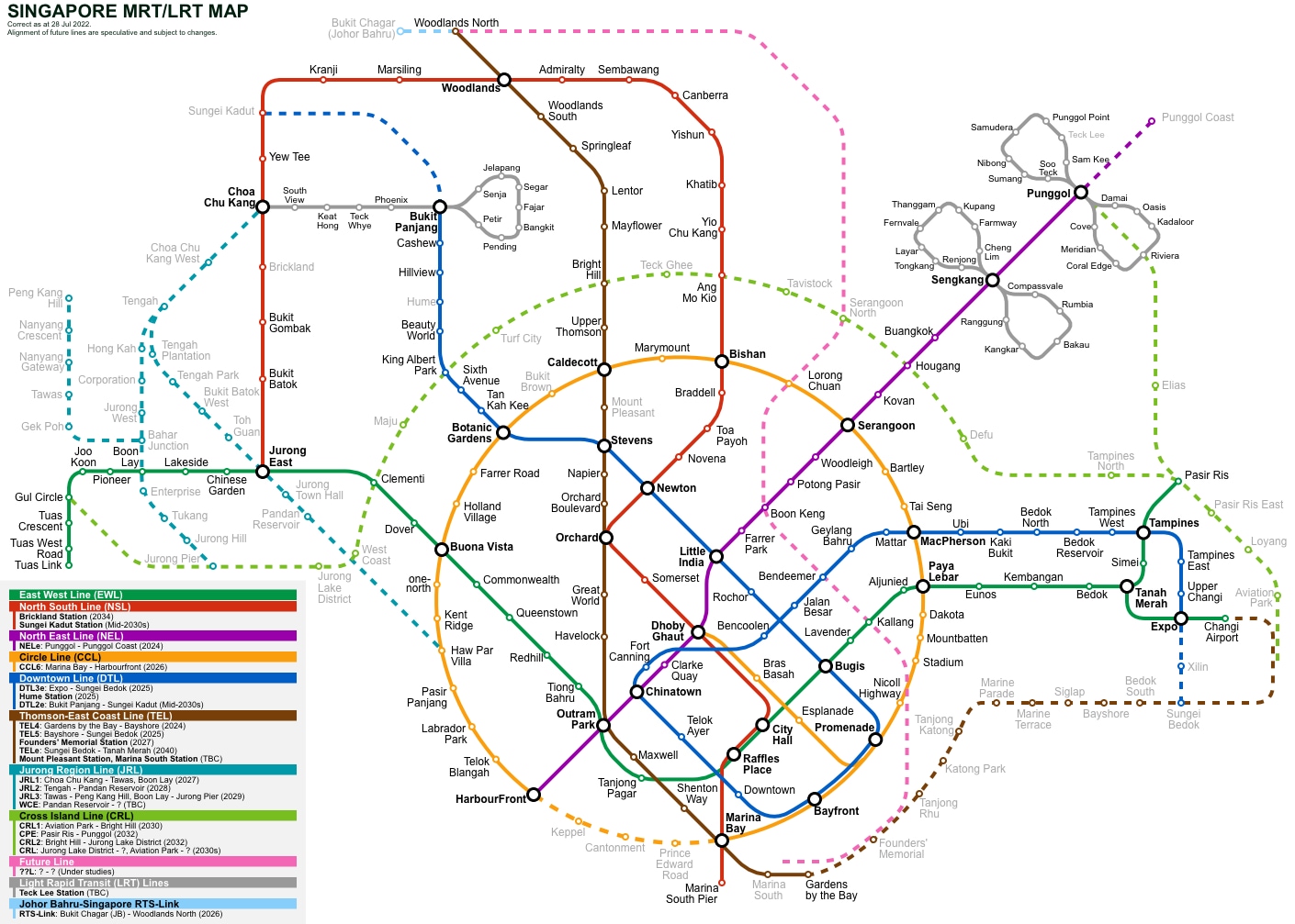
MRT, LRT and Future Lines
LTA interactive map with info for each station’s first & last train.
Google map overlay with future lines.
Another fantastic resource is SGTrains, built by enthusiasts, with details on upcoming lines/stations and also a history!