
3D SUN STUDY & SITE PLAN
Lentor Gardens Residences 3D Model
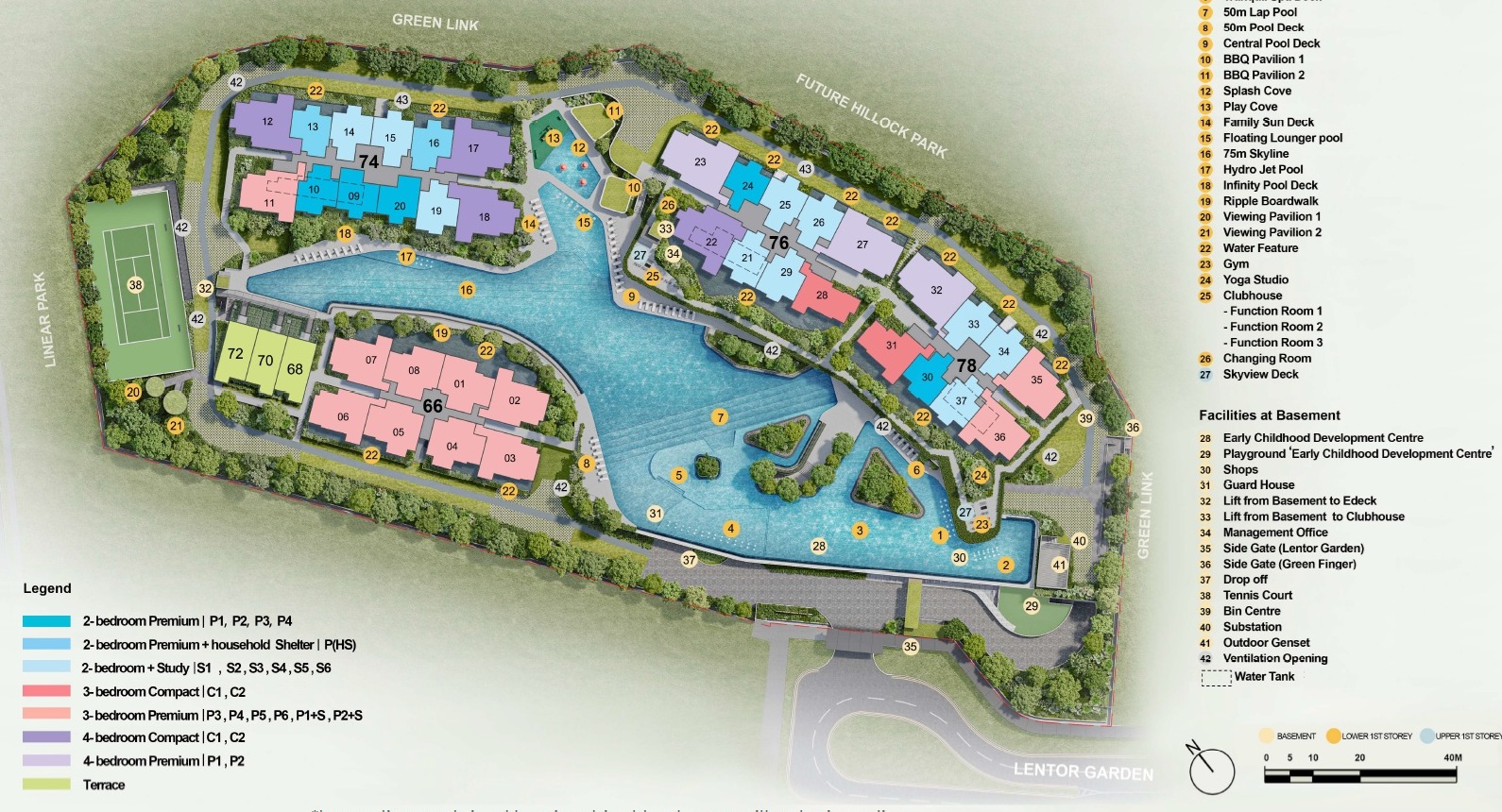
Explore the Lentor Gardens Residences 3D model and site plan. Compare seasonal sun paths, estimated building shadows and stack sun exposure.
Loading the 3D site plan…
Position reference: © OpenStreetMap contributors.
ESTIMATED HEAT
Stack heat exposure
Select a stack to see its heat exposure over the day.
How to use the 3D model
Drag to rotate the model and compare block positions, or choose Top view to look from above. Use the time slider and season buttons to compare estimated sun paths and shadows. Select a stack in the heat table for its relative heat exposure and average morning and afternoon sun hours.
The map layers button switches between the developer site plan, Satellite and Street map. For floor plans, pricing and project details, visit the Lentor Gardens Residences launch guide.
This model is based on developer site plans and assumed floor heights. Sun and heat figures are estimates; the shadow calculation excludes buildings outside the model, trees and terrain. Map alignment is a visual reference, and satellite imagery may show an earlier stage of the site.